Your cart is currently empty
Product image slideshow Items
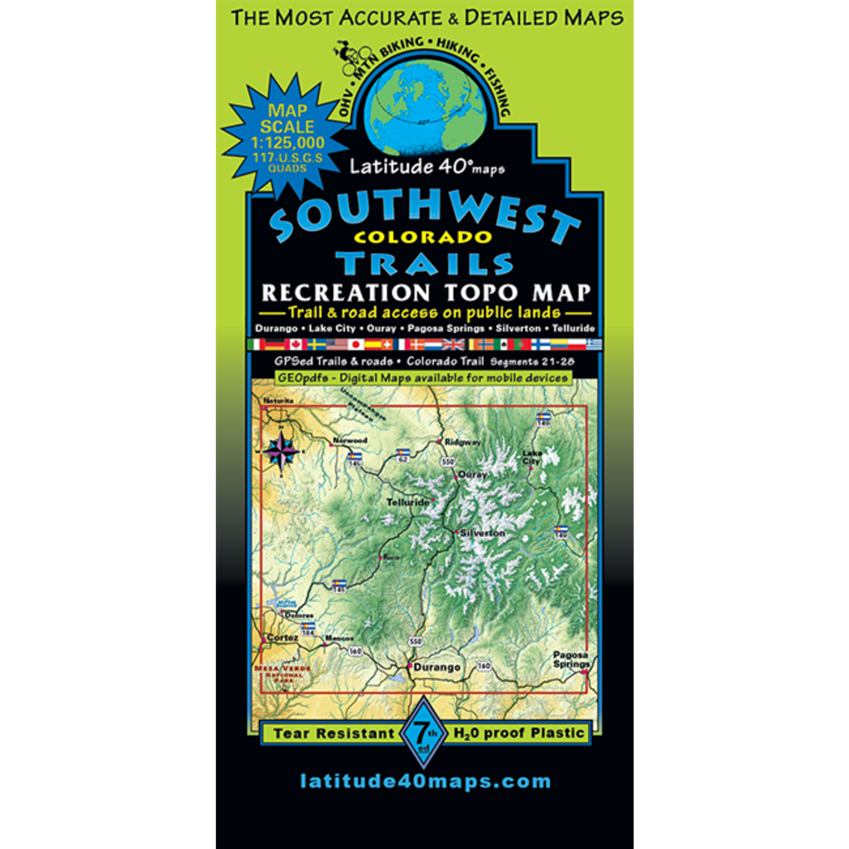
Map Coverage covers all or part of 117 USGS 1:24,000 7.5-minute topographic maps:
North – Ridgway State Park
South – Mesa Verde National Park
East – Pagosa Springs
West – Cortez
This map covers the largest area with topographic detail. It has all roads and trails and includes the mountains around Cortez, Durango, Pagosa, Lake City, Ridgeway, Ouray, Telluride and Silverton.
Includes parts of the San Juan, Uncompahgre, Gunnison, and Rio Grande National Forests, and Tres Rios, Uncompahgre, Gunnison and San Luis BLM areas as well as Mesa Verde National Park.
1:125,000 scale. 100 foot contours. 2006 Version
Map Coverage covers all or part of 117 USGS 1:24,000 7.5-minute topographic maps:
Scale 1:125,000 or 1″= 2 miles
Contour Interval 100 feet with shaded relief base
Latest Edition 5th – 2015
Notes
This “big picture” map is great for planning where to go and how to get there.
Product carousel items


